


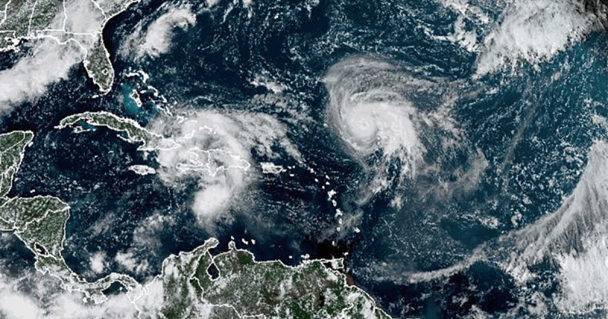
Hurricane Humberto has intensified to a Category 4 storm, registering maximum sustained winds of 145 mph as of 11 p.m. on September 13, 2023. Forecasters from the National Hurricane Center indicate that while Humberto is expected to strengthen further, it will likely remain offshore, avoiding the U.S. East Coast. There are currently no coastal watches or warnings in effect.
The forecast track suggests that Humberto will move northwest and then shift north and northeast, passing between the U.S. East Coast and Bermuda. This pattern indicates a safe passage away from populated areas, minimizing immediate risks to coastal communities.
In addition to Humberto, meteorologists are monitoring a second disturbance, designated as Potential Tropical Cyclone 9. Located northwest of Cuba, this system is projected to strengthen into a tropical storm over the weekend. Forecasters anticipate that it may reach hurricane intensity as it approaches the southeastern U.S. coast early next week, raising concerns about potential storm surge and wind impacts.
According to the National Hurricane Center, a tropical storm warning is currently in effect for the Central Bahamas, while a tropical storm watch has been issued for parts of the northwest Bahamas. As of Friday night, the maximum sustained winds for Potential Tropical Cyclone 9 were recorded at 35 mph. A tropical storm is characterized by sustained winds ranging from 39 to 73 mph.
This developing system is predicted to bring substantial rainfall, with forecasts suggesting up to 12 inches for eastern Cuba and between 4 to 8 inches for the Bahamas. As it continues its northward trajectory, it is expected to approach Florida’s Atlantic coast and move toward South Carolina by Monday and Tuesday.
The National Hurricane Center noted that there is significantly more uncertainty regarding the storm’s track beyond the initial three-day forecast period. They indicated that the system may considerably slow down or even stall near the South Carolina coast, which could exacerbate rainfall and flooding risks in the region.
As the situation develops, residents along the southeastern U.S. coast are advised to remain vigilant and stay informed about the latest updates from official meteorological sources.