


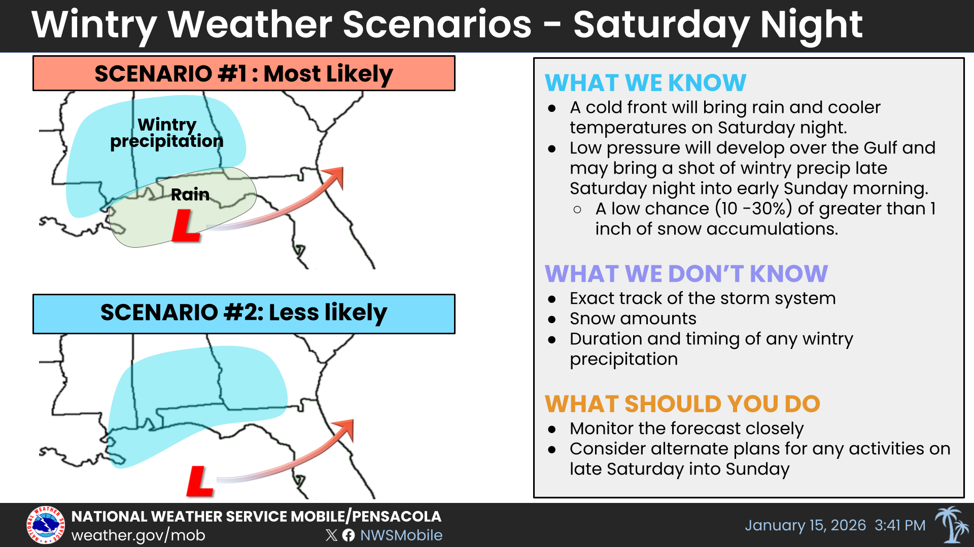
URGENT UPDATE: The National Weather Service (NWS) in Mobile has issued a winter weather forecast indicating a potential for snow on Saturday night. The forecast, released at 4 p.m. Thursday, outlines two critical scenarios that could impact our area.
Scenario One suggests that a low-pressure system may fail to develop over the northern Gulf or track further north. If this occurs, residents can expect light rain on Saturday evening transitioning to a wintry mix or snow overnight. Accumulations in this case are likely to remain light, with most areas seeing less than 0.5 inch of snow. However, under a reasonable worst-case scenario, accumulations could reach 0.75-1 inch.
In contrast, Scenario Two—though deemed less likely—forecasts the formation of low pressure over the northern Gulf, tracking further south. This scenario could lead to a longer duration of wintry precipitation, with light snow accumulations and the potential for brief heavy snow. Should this scenario develop, the most likely snow accumulations are projected to be between 0.75-1 inch, with a reasonable worst-case scenario of 1-2 inches, particularly in areas east of I-65.
The NWS will provide updates and alert local emergency management agencies around 7 a.m. Friday as the situation develops. Residents are advised to stay tuned for the latest information and prepare for potential impacts from winter weather.
This rapidly changing forecast highlights the need for vigilance as conditions could shift. Prepare now, as even light accumulations can affect travel and daily activities. As always, the safety of our community is paramount, and residents should take all necessary precautions when venturing out during winter conditions.
Stay informed and share this urgent weather update with friends and family to ensure everyone is prepared for the potential winter weather ahead!