


UPDATE: A significant threat of severe thunderstorms is developing across central Oklahoma today, with weather officials warning of potential hazards including large hail and strong winds. This urgent weather alert comes as a cold front moves southeast through the region, creating conditions ripe for dangerous storms.
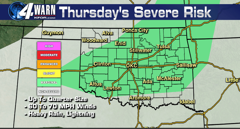
As of October 12, 2023, the cold front is expected to stall over southeastern Oklahoma later today and into the evening, increasing the likelihood of scattered thunderstorms. Meteorologists are particularly concerned about the potential for severe weather, with large hail and wind gusts topping 60 mph identified as the main threats.
Heavy rainfall and frequent lightning strikes are additional dangers associated with these storms. Authorities are urging residents to stay vigilant and monitor local weather updates throughout the day.
The National Weather Service emphasizes the importance of preparedness as conditions can change rapidly. “Stay tuned for the latest weather updates and have a plan in place,” officials advise, highlighting the need for safety as storms approach.
As the afternoon progresses, the risk of severe thunderstorms is likely to increase, particularly in areas near the stalled front. Residents are encouraged to secure outdoor items and prepare for potential power outages due to strong winds.
This developing situation underscores the unpredictability of severe weather in the region. Stay informed and prioritize safety as you navigate through the day.
For the latest updates, follow local news channels and heed any warnings from weather authorities.