


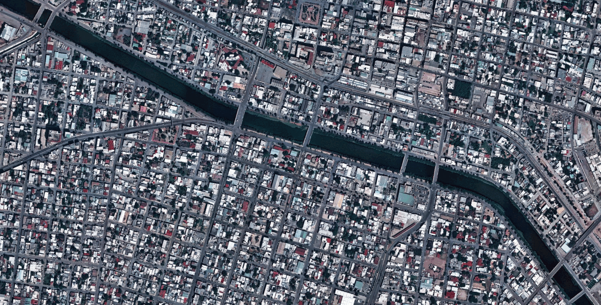
Maxar Intelligence has introduced a groundbreaking mapping product, developed in collaboration with Ecopia AI, that transforms satellite imagery into detailed two-dimensional and three-dimensional maps. The new offering, named Vivid Features, merges Maxar’s extensive satellite imagery archive with Ecopia’s advanced artificial intelligence software to automatically identify and delineate key geographical elements such as buildings, roads, vegetation, and water bodies.
Traditionally, maps have relied on raster images, which represent visual data as pixels. In contrast, vector maps employ geometric shapes—points, lines, and polygons—to depict the world, storing location data in mathematical equations. This method enhances precision and simplifies updates, making it vital for various applications, including urban planning and defense operations. Nevertheless, maintaining current vector datasets has historically been a slow and labor-intensive process. The collaboration between Maxar and Ecopia aims to alleviate these challenges.
According to a statement released on September 17, 2023, Maxar highlighted the difficulties mapmakers face in updating vector maps to reflect the current reality. The company noted, “Mapmakers are stuck with laborious processes to update vector maps that reflect the ground truth, a process that takes days and misses critical developments.” The introduction of Vivid Features is posited to revolutionize this process, offering accurately aligned vector maps that can be trusted by both mapping systems and AI models. The system boasts a consistent accuracy of within three meters, ensuring that when AI flags a new building or road, users can be confident in its presence.
Founded in 2013, Ecopia AI specializes in utilizing artificial intelligence to extract features from high-resolution satellite imagery, effectively creating what it terms a “digital twin of the Earth.” Its machine learning models can autonomously identify and outline diverse geographic features, significantly reducing the need for human intervention. By integrating these capabilities with Maxar’s global satellite archive, the two companies assert that they can automatically generate vector maps that evolve in tandem with real-world changes.
Peter Wilczynski, Chief Product Officer at Maxar, emphasized the significance of this innovation: “Vivid Features, powered by Ecopia, solves one of the most persistent challenges in digital mapping—the time-consuming process of producing consistent vector map data of every place on Earth.” He added that the partnership has produced a solution that eliminates the extensive hours customers typically invest in manual vector creation, thereby delivering a dynamic basemap suite that maintains its accuracy as global conditions change.
The potential applications for this technology are vast. Government agencies can leverage accurate geospatial data for emergency planning, disaster response, and infrastructure management. In the commercial sector, businesses may utilize it for risk modeling in insurance, telecom network planning, and tracking population growth. For military users, vector maps can provide critical geospatial intelligence that supports mission planning and decision-making processes.
Jon Lipinski, President and Co-Founder of Ecopia, discussed the complexities of understanding our planet’s evolving landscape. He stated, “Gaining an up-to-date, three-dimensional understanding of our planet and how it is changing is one of the most complex challenges our customers face.” Despite the millions of square kilometers of satellite images captured daily, many organizations struggle to develop and maintain corresponding three-dimensional vector maps that accurately reflect real-world changes. This partnership with Maxar is expected to facilitate unprecedented access to up-to-date 3D vector maps globally.
Based in Westminster, Colorado, Maxar operates a fleet of high-resolution imaging satellites and has long supplied imagery to both commercial clients and the U.S. government. Toronto-based Ecopia AI has carved a niche in applying AI and machine learning to address geospatial challenges and has previously partnered with significant players within the sector. The collaboration between these two innovative companies marks a significant step forward in the realm of digital mapping, promising to enhance the accuracy and efficiency of geospatial data generation worldwide.